You have three choices: 1) Local Getaways—inspirational California travel content; 2) Foodie Friday—because life’s too short for a bad meal; and 3) Aloha Friday—delivering a dose of sunshine to your inbox.
Local Getaways Express is a digest-sized quarterly booklet for visitors to San Francisco and the Greater Bay Area, including listings for restaurants, museums, galleries and more!
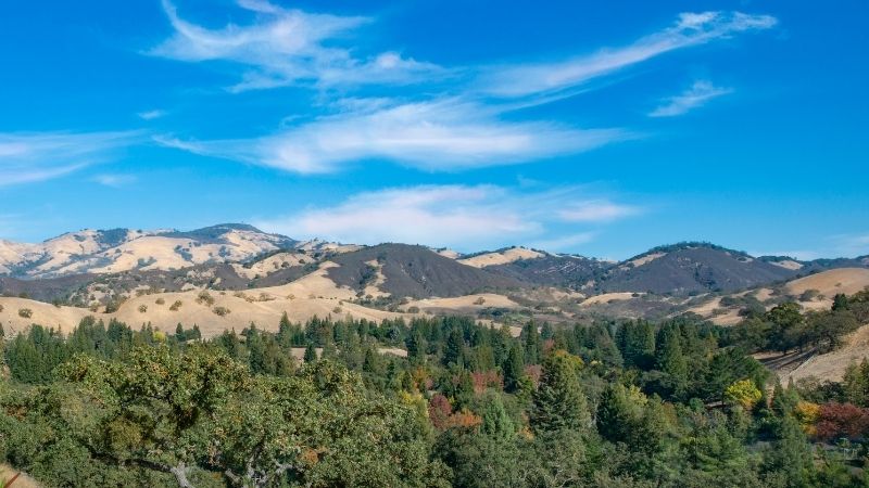
In the Bay Area, it’s usually the North Bay and the South Bay that get all the hiking attention. But the East Bay not only offers trails for all skill levels, it also serves up views of the entire Bay from Mt. Tamalpais and the Golden Gate Bridge, all the way down to South San Francisco. And, because most of these trails have west-facing viewpoints, the sunset hikes are hard to beat. Here are our top picks for the best hikes in the East Bay.
*Wildfires happen, things change — be sure to check the trail status before you go.
Photo Credit: Dana Shcurr/AllTrails
Photo: AllTrails
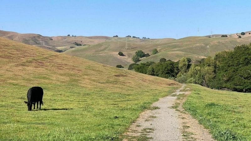
Bay Area Ridge Trail: Fernandez Ranch
PORT COSTA
Level: Easy to moderate — 4.7 miles
Walk through the quintessential California landscape of open grassland and oak-bay woodland on this point-to-point trail system. In the springtime, the rolling hills of Fernandez Ranch are sprinkled with golden poppies, lupine and Mt. Diablo sunflower. Not to mention the year-round wildlife. Great for longer dog walks or just a nice place to stretch your legs, there is plenty to see landscape-wise, and you can even wave at cows along the way. EBMUD permit required.
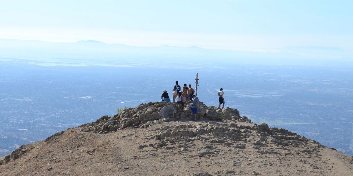
Accessible year-round, this 3,848-foot summit is the tallest peak in the Bay Area. But don’t worry, it’s a steady incline. A popular area for mountain biking, hiking and nature trips, there’s plenty to see and no shortage of incline — take in the surroundings on your rest breaks. If you happen to go on a foggy day, get ready for a treat: the clouds sometimes settle around 1,000 feet below the summit, giving you the opportunity to watch the clouds roll by below you. Note: $10 parking fee.
With an ascent of nearly 2,200 feet, this is a hike you will definitely need to plan for. Bring lots of water and wear hiking boots as there are no switchbacks here, just a constant incline. The view is well worth it — weather permitting, you’ll be able to see as far as Oakland and San Francisco from the top. Parking is limited so get there early, which is also advisable due to lack of shade.
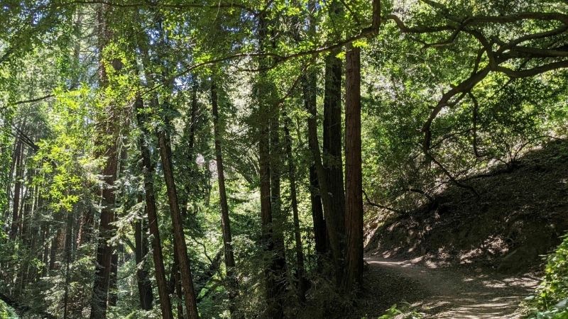
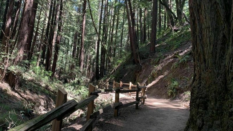
Shaded by Redwoods, this trail weaves through the canyon of Joaquin Miller Park along the Palo Seco Creek. Just over 800 feet of elevation in total, it’s great for all skill levels — however, it’s not ideal for large groups as the trail is narrow in places and frequented by mountain bikers. Tip: If you don’t want to start with a climb, do the trail counterclockwise. Because this is a multi-use trail, all dogs are required to be on leash.
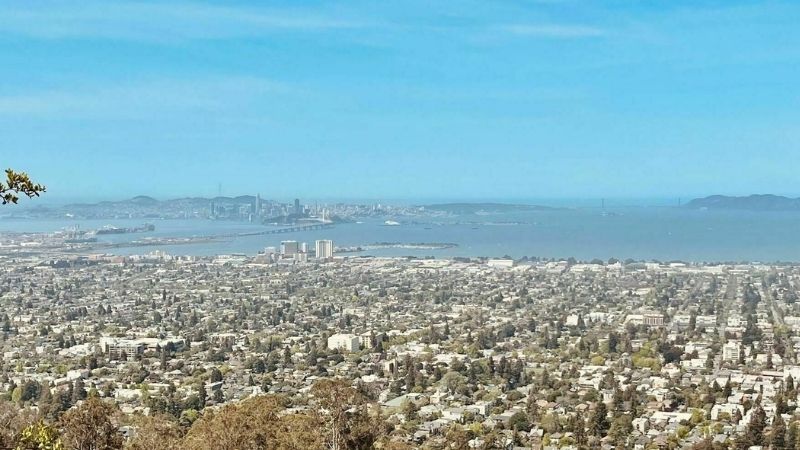
Spend a day soaking up college town culture and good food in Berkeley and then an evening watching the glow of sunset pour over the Golden Gate. This is your go-to hike for the latter. With views for days, this short out-and-back hike brings you up 700 feet — with a couple leg-burner sections — so you can enjoy a panoramic overlook.
Located in a hidden redwood forest only 15 minutes outside Oakland, this trail is great for a quick jaunt into nature. Meander through Reinhardt Redwood Regional Park on this partially paved path. It’s wide enough for maintaining a six-feet distance when passing and long enough that the 800-foot climb is gradual and very doable. The first half of the trail is shaded, the second is exposed and provides vistas from the East Ridge. Do the trail in reverse on a hot day.
Wildcat Creek, Havey Creek, San Pablo Ridge and Belgum Trail Loop
RICHMOND
Level: Moderate — 7.2 miles
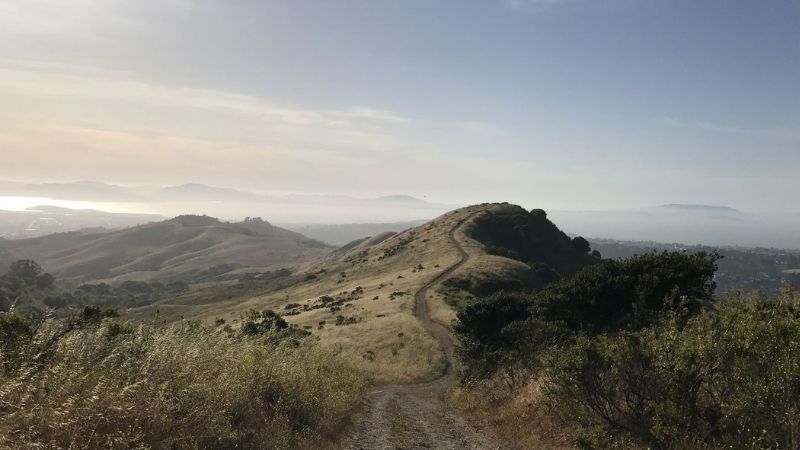
The epitome of a nice backyard hike, this trail starts in Alvarado Park and loops around the adjacent Wildcat Canyon Regional Park. Wildlife abounds — cows, foxes, coyotes — as does California flora. Your dog(s) will enjoy it as much as you do. Cresting the San Pablo Ridge gives 360-degree views of rolling hills, the Golden Gate Bridge and the sprawling Bay. Tip: Water bottle refilling opportunity two miles into the hike.
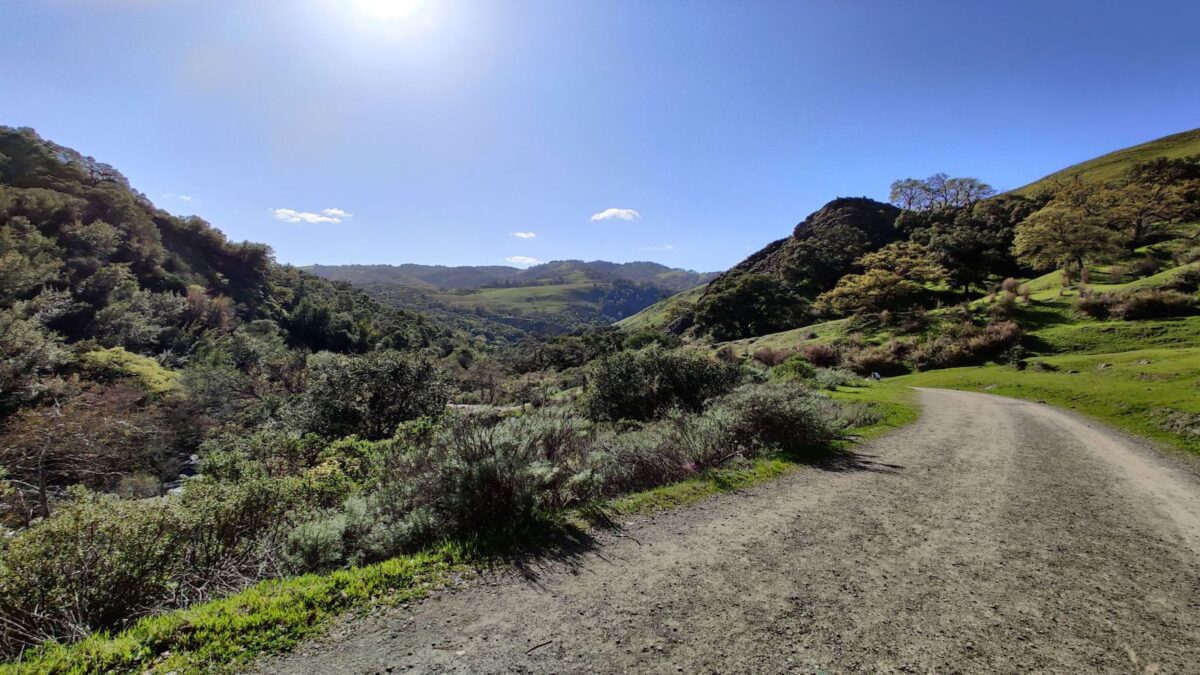
Who knew the East Bay had its own Yosemite? This trail is located in Sunol Wilderness Regional Preserve and offers a gentle uphill incline on a gravel path. Perfect for those who want a little bit of a challenge without breaking a sweat. Tip: Be sure to apply sunscreen and bring a hat because no shade is available. It’s worth visiting if you’re visiting Fremont for the day or looking for a campground.