You have three choices: 1) Local Getaways—inspirational California travel content; 2) Foodie Friday—because life’s too short for a bad meal; and 3) Aloha Friday—delivering a dose of sunshine to your inbox.
Local Getaways Express is a digest-sized quarterly booklet for visitors to San Francisco and the Greater Bay Area, including listings for restaurants, museums, galleries and more!
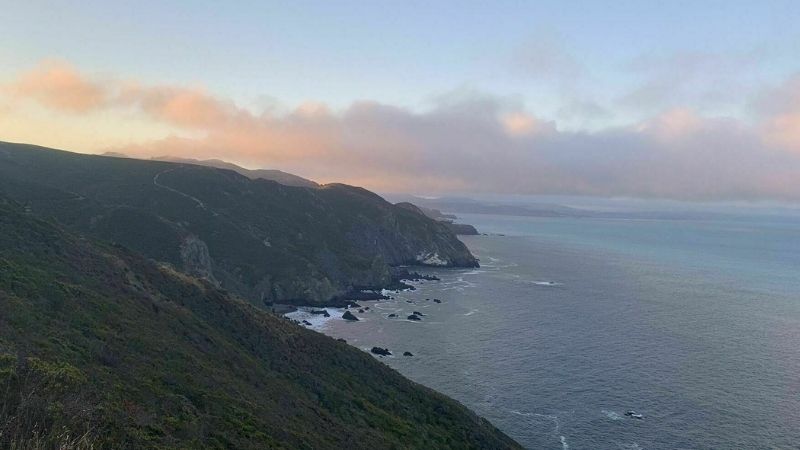
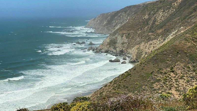
Venture a few miles north of San Francisco and enter a hiking haven like none other. Home to Muir Woods National Monument, after the famed environmentalist John Muir, the North Bay comprises the Golden Gate National Recreation Area, Tamalpais State Park and Point Reyes National Seashore as well as Tomales Bay and Samuel P. Taylor State Parks. If you’re feeling adventurous, there’s few better places to customize your route — the trail system in the North Bay (especially in the Marin Headlands and on Mt. Tam) is a network of connections just waiting to be configured.
Whether the mountains, forests or beaches be callin’ (if we may paraphrase John Muir), you can find them here — accessible all year round. While there are thousands of trails here, we’ve selected a few of our favorites that showcase the range this land has to offer. Here are the hikes we love in the North Bay.
NOTE: Not only is this prime hiking ground, it is also the land of the mountain bike, which means many of the trails are multi-use. Be alert and courteous, whether on foot or wheels.
*Wildfires happen, things change — make sure you check the trail status before you go.
Photo Credit: Ron Filson
Photo: Christian C/AllTrails
Alamere Falls via Coast Trail from Palomarin Trailhead
BOLINAS
Level: Moderate — 11 miles
We know, the instructions are unclear: should you chase waterfalls or not? Here, we highly recommend you at least seek them out. A bit of a longer haul, Alamere Falls is a quintessential Marin hike. The falls spill off the rocky cliff face and flow directly into the ocean. There’s a shortcut (not maintained by the NPS) that can shave off about four miles, but requires a bit of climbing. If you forego this option, the actual trail is mostly flat and leads you directly to the beach where the falls, well… fall. Go early, the parking lot is small. Tip: Poison oak grows along the trail. Wear clothing that covers extremities if you’re prone to the “I don’t even know how I got poison oak there” syndrome. Or just know how to spot it before you go.
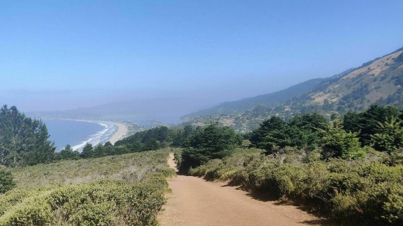
You know how they say it’s not about the destination, but the journey? Well, step aside clichés because this trail gives you both a journey AND a destination. How does walking under the shade of eucalyptus trees sound? A picnic at Muir Beach without the chore of parking in it’s infamously small lot? Did we mention coastal views on 80 percent of the trail? C’mon, tell us that’s not the perfect weekend hike. To be transparent, there is a slight caveat, if you’re not feeling a good glute workout. The hike back from Muir Beach to the trailhead is a good 1,300 feet up — everyone feels it a little — but set your own pace and you’ll ride the high of this trail’s crazy beautiful view. Go for a picnic, catch some rays and mosey on back for a well-deserved beer in Tam Junction.
This list simply wouldn’t be complete without the notorious Dipsea. Attached to a century-long annual event, the Dipsea Race, this trail is as connected to the local community and culture as it could be. The trail (including quite a few stairs) stretches from Mill Valley to Stinson Beach with over 2,000 feet of climbing. Starting at Old Mill Park in downtown Mill Valley, three flights of stairs — as tall as a 50-story building — meet up with Panoramic Highway where the trail dips and begins to weave through Muir Woods. On the Stinson end, rolling hills lead into the lush, shaded groves of Steep Ravine. Treat yourself to something refreshing in Stinson — lunch, drinks, a dip in the Pacific, whatever suits your fancy. Pro tip: Unless you want to head back on the trail for another 7.4 miles (the Double Dipsea), plan to leave a car at Stinson or take the Marin Transit shuttle #61 back to Mill Valley.
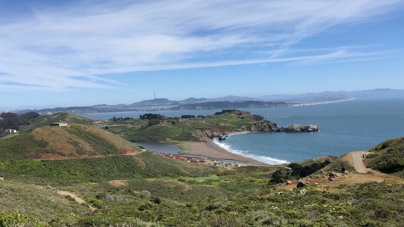
Bunkers, butt burner, Bay views — oh my! This well-maintained and partially-paved (lower section) trail sits just above Rodeo Beach, where surfers, dog parents and picnickers alike go to enjoy the rather large, yet less-populated sand and sea setting. On a clear day, the top of Hill 88, an important Nike missile radar site during the Cold War, provides sweeping views of San Francisco and the Golden Gate Bridge from the west. Listen for seals below and seagulls soaring above. With roughly 1,000 feet of elevation gain, don’t cave before reaching the top; the view of the city through the graffitied frame of a bunker window is something you’ll want to capture. Overall, it’s a lovely place to be on a warm day — there’s almost always a nice breeze, which helps with the lack of shade along the trail. Tip: If you’re going on a weekend, plan to go early to avoid heavy traffic midday — the only road in is a single lane.
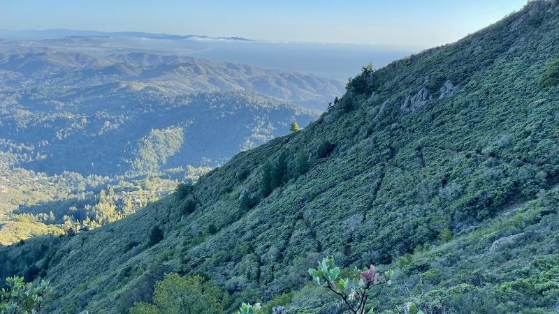
Looking for that uphill high? This one’s for you. With an almost constant incline — a 20 percent grade — for two miles up to Mt. Tam’s East Peak, you’ll get the blood pumping and have one of the best views around. Never a dull moment, this trail challenges with rocky terrain and the option for some scrambling at the top. There are beautiful views the entire way up, so feel free to disguise catching your breath with taking in the scenery. Deep gullies from rainwater runoff make the crab walk both a necessity and a source of entertainment (whether you’re hiking alone or with others) on parts of this trail. Bring a good attitude and good hiking boots.
Tomales Point is at the northern tip of Point Reyes National Seashore. By far the farthest journey by car, this trail is worth planning a day around. Located at the historic Pierce Point Ranch, take a step back in time to the early dairy ranching days or simply admire the wildlife that roams this Coast Miwok land. Find tule elk grazing freely and over 490 avian species for your birding pleasure. Wildflowers speckle the narrow peninsula and the coastline mimics that of the rugged Central Coast. A windbreaker is advised as the ridge can get blustery. Note: Pack plenty of water (there are no potable re-filling stations here) and grab some grub in Point Reyes Station (*ahem* Bovine Bakery).